Navigation
Were all the natives subject to this unimaginable cruelty?
No, those who were not exposed to this cruelty were forced to work in the mines. Others died of disease and malnutrition. The Ecomienda System greater increased the cruelty to the point where the natives just simply committed suicide. Seven thousand babies died in three months and by 1496, the population of Espanola had decreased from eight million to four million. By 1508, it was less than 100,000 and by 1518, it was less than 20,000. Scholars say that in 1535, the native population of Espanola was less than twenty!
The killing of Natives through pit spiking
|
The burning of mass Natives |
Discover: To make known or visible - to obtain sight or knowledge for the first time.
Conquest: The act of conquering territory appropriate in battle, overcome by force of arms, collect.
When referring to Christopher Columbus, it was not a discovery but it was a conquest. Most historians will agree that the Columbus story has been altered a great deal and herofied. However, they will try to stay away from various details concerning his role in the Transatlantic Slave Capture. Professor Robert H. Fuson claims that Columbus encountered warlike and unattractive natives. The truth is that, according to Columbus’ own logs, the natives showed nothing but hospitality and love for Columbus and his crew. It was also documented that Columbus thought of these people as very attractive and even handsome. If it was not for the natives, Columbus and his crew would have starved to death in 1492. Professor Fuson goes on to state that Columbus did not run Indian slaves but that history misrepresented and misinterpreted Columbus. Fuson goes on to say that Columbus had nothing but love and respect for the natives and that he had the utmost intent to simply introduce them to Christ and ignore the fact they there was gold on the land. Fuson insists that this is a true account, based on the fact that Columbus was a devout Christian. Professor Fuson states that Columbus was courageous, loyal, religious and the best navigator of his time. Let’s take a look at other so-called, "devout" Christians.
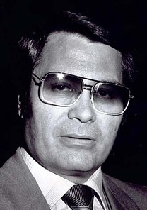
Reverend Jim Jones
|

Murdered 911 of his followers in British Guyana with what he called, "Revolutionary Suicide." Those who did not kill themselves for the glory of Christ were executed. Men, woman, children and even animals.
|
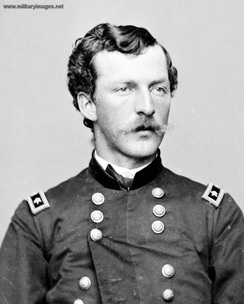
Lieutenant Appleton Miles
|
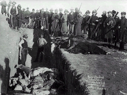
Lieutenant Appleton Miles of the U.S. Army ordered the death of 300 Sioux Indians at the Massacre at Wounded Knee. Miles was also a so-called, devout Christian!
|

Brazilians slaughtered by Christian missionaries |

Indians massacred by Christian rebels |
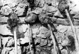
European Christians using the head on spike
|

Adolph Hitler was also a devout Christian
|
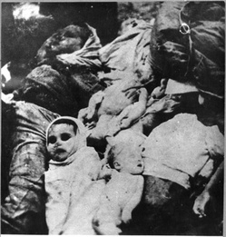
Hilter even slaughtered babies
|
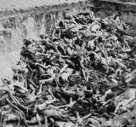
And millions more
|
Is it true that Columbus was a great navigator?
On Columbus’ 1492 journey, he had no clue of his whereabouts. Columbus made incredible navigational errors. Columbus thought that the circumference of the earth was 204,000 miles in which he underestimated by 25%. Upon reaching the shores of Espanola, Columbus initially thought that he had landed in China. He then retracted his ignorance and thought that he was in the East Indies. Columbus made grave geographical mistakes of distance and location. However, Professor Fuson claims that Columbus had excellent knowledge of distance and speed. Dr. Fuson makes the excuse for Columbus’ errors by stating that the determination of latitude and longitude at the equator was not established until after 1669. Asian and African traders had been successfully sailing to West without maps and charts since the 5th Century. Asian and African traders such as Hsu-Shen (Hexian) of the Shang Dynasty of China in 459 A.D. and the Idrisid of Morocco in the 4th and 5th Century traveled to America. Asians and Africans chartered islands by sailing on drift routes, winds and tides like the Canary Current, North Equatorial Current, Gulf Stream and Northern Western line Winds which travel West of the Atlantic. Columbus had no in-depth knowledge of these routes. He knew that they existed but he had no idea of the routes. Columbus relied on the compass for his journeys. Earlier sailors were celestial sailors who used the stars to navigate their ships to their destination. Columbus was not skilled in celestial mapping. Columbus relied on dead-reckoning navigation. The truth is that Columbus did not discover the natives. Columbus was drunk and lost and the natives discovered him!
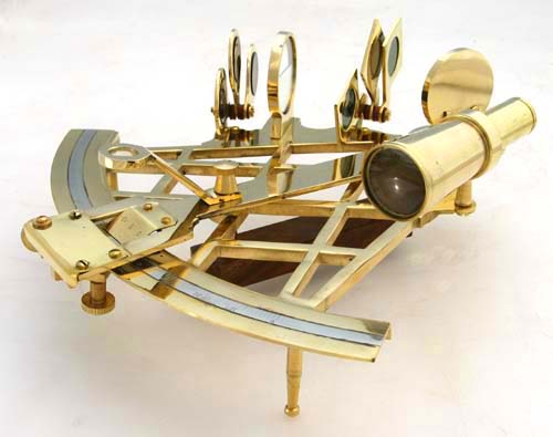
Celestial Navigator used by Africans and Asians |
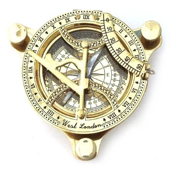
Nautical compass used by Columbus
|
Could you explain what different types of Navigation there are?
At the end of the 15th Century, celestial navigation was just being developed in Europe, primarily by the Portuguese. Prior to the development of celestial navigation, sailors navigated by "deduced" (or "dead") reckoning, hereafter called DR. This was the method used by Columbus and most other sailors of his era. In DR, the navigator finds his position by measuring the course and distance he has sailed from some known point. Starting from a known point, such as a port, the navigator measures out his course and distance from that point on a chart, pricking the chart with a pin to mark the new position. Each day's ending position would be the starting point for the next day's course-and-distance measurement. In order for this method to work, the navigator needs a way to measure his course and a way to measure the distance sailed. Course was measured by a magnetic compass, which had been known in Europe since at least 1183. Distance was determined by a time and speed calculation, the navigator multiplied the speed of the vessel (in miles per hour) by the time traveled to get the distance. In Columbus' day, the ship's speed was measured by throwing a piece of flotsam over the side of the ship. There were two marks on the ship's rail a measured distance apart. When the flotsam passed the forward mark, the pilot would start a quick chant, and when it passed the aft mark, the pilot would stop chanting (the exact words to such a chant are part of a lost oral tradition of medieval navigation). The pilot would note the last syllable reached in the chant, and he had a mnemonic that would convert that syllable into a speed in miles per hour. This method would not work when the ship was moving very slowly, since the chant would run to the end before the flotsam had reached the aft mark.
Speed (and distance) was measured every hour. The officer of the watch would keep track of the speed and course sailed every hour by using a toleta or traverse board. This was a pegboard with holes radiating from the center along every point of the compass. The peg was moved from the center along the course traveled, for the distance made during that hour. After four hours, another peg was used to represent the distance made good in leagues during the whole watch. At the end of the day, the total distance and course for the day was transferred to the chart. Columbus was the first sailor (that we know of) who kept a detailed log of his voyages, but only the log of the first voyage survived in any detail. It is by these records that we know how Columbus navigated and how we know that he was primarily a DR navigator. Since DR is dependent upon continuous measurements of course and distance sailed, we should expect that any log kept by a DR navigator would have these records, and this is exactly what Columbus' log looked like. If Columbus had been a celestial navigator, we would expect to see continuous records of celestial observations, but Columbus' log does not show such records during either of the transatlantic portions of the first voyage. It has been thought by some scholars that Columbus was a celestial navigator anyway and kept his celestial records hidden for some unknown reason (this supposition is necessary to support some theories of the first landfall), but this hypothesis does not hold water. Columbus' ships were steered by helmsmen at a tiller below the quarterdeck. The helmsmen could not see the sky, so the only way they could keep a course was by magnetic compass.
The officer of the deck had his own compass and he would call down course changes as necessary. This means that the courses used aboard ship (and in the log) would have been magnetic courses. Now suppose that Columbus was using unrecorded celestial checks on his latitude as he sailed west on his first voyage. In that case, as magnetic variation pulled his course southward from true west, he would have noticed the discrepancy from his celestial observations and he would have corrected it. In other words, if Columbus was a celestial navigator, we would expect to see a series of small intermittent course corrections in order to stay at a celestially determined latitude. These corrections should occur about every three or four days, perhaps more often, but that is not what the log shows. On the first voyage westbound, Columbus sticks doggedly to his (magnetic) westward course for weeks at a time. Only three times does Columbus depart from this course, once because of contrary winds and twice to chase false signs of land southwest. In none of these cases does he show any desire to return to a celestially-determined latitude. This argument is a killer for the celestial hypothesis and was first made by Rear Admiral Bob McNitt (USN) in 1992. Well then, could Columbus have corrected his compasses by checking them against the stars -- and thus avoid the need for course corrections? This would have been possible in theory, but we know that Columbus could not have actually done this. On his return voyage in 1493, Columbus started from Samana Bay on the north Coast of Hispaniola and he made landfall at Santa Maria Island in the Azores. We know all of his DR courses and distances between these two points since they're recorded in his log. Following these courses and distances using a corrected compass puts Columbus over two hundred miles southeast of the Azores at the time he should be in sight of them. The only way to get from Hispaniola to the Azores using Columbus' recorded courses and distances is to assume that he was using an uncorrected compass and that he was pulled leftward by westerly magnetic variation in the Atlantic. Applying the same assumptions to the westward voyage shows that Columbus must have been using dead reckoning rather than celestial navigation, because of the absence of course corrections. On the westward passage, this same magnetic variation would have pulled his fleet leftward into the southern Bahama Islands, where most landfall theories put him.
In celestial navigation, the navigator observes celestial bodies (sun, moon and stars) to measure his latitude (in Columbus day, it was usually impossible to measure your longitude.) Even in ancient times, it was fairly easy to find your latitude by looking at the sun and stars, as long as you weren't too concerned about accuracy. Each star has a celestial latitude, or declination. If you know the declination of a star that is directly overhead, that's the same as your latitude on earth. Even if a star isn't directly overhead, if you can measure the angle between the star and the overhead point (called the zenith), you can still determine your latitude that way -- provided you measure the star at the time of night that it is highest in the sky. However, in the Mediterranean Sea, it's not very useful to find your latitude because your latitude is roughly the same wherever you are. In those confined waters, dead reckoning was the easiest way to navigate. It was not until the 15th Century, when Portuguese mariners began to make long voyages north and south along the Coast of Africa, that celestial determination of latitude began to be useful for southern European sailors. Columbus was from Genoa, one of the leading Mediterranean ports, and he must have learned his dead reckoning navigation from Genoese pilots. But he had spent time in Portugal and was aware of all the new ideas in navigation, including celestial navigation. So on his first voyage, he made at least five separate attempts to measure his latitude using celestial methods. Not one of these attempts was successful, in part because of bad luck and in part because of Columbus' own ignorance of celestial techniques and tools.
Could this had been the reason for Columbus’ poor navigation?
After navigating successfully across the Atlantic using his familiar dead reckoning methods, Columbus tried to find his latitude using the quadrant on October 30, 1492. At the time, he was at Puerto de Mares, Cuba, usually identified with the modern Puerto Gibara at about 20 degrees North latitude, but the result he obtained from the quadrant was 42 degrees. He made another reading from the same place on November 2nd and got the same flawed result. Continuing along the Coast of Cuba, Columbus again tried a quadrant latitude reading on November 21st and again came up with 42 degrees. Columbus was by now aware that the quadrant reading was incorrect, but he dutifully recorded the reading in his log anyway -- he blamed the quadrant for the bad result and remarked that he would not take any more readings until the quadrant could be fixed. Columbus made two separate attempts to measure his latitude by two different methods on December 13th while anchored in a harbor in northern Haiti. Columbus had read works by the Greek astronomer Ptolemy and he knew that Ptolemy often referred to a city's latitude according to the length of daylight at the summer solstice (more northerly places have longer daylight at summer solstice). December 13th was the day after the winter solstice in 1492, which is just as good for latitude measurements (because the length of daylight at summer solstice is about the same as the length of night at winter solstice). Columbus took the opportunity to measure the length of daylight, finding that the day was 10 hours long. This is also a fairly bad result, but Columbus did not convert the daylight measurement into a latitude probably because he did not know enough trigonometry to do so. That night, he made his second attempt to determine latitude within 24 hours. Going back to the quadrant, he again tried to determine the altitude of the North Star and this time got a reading of 34 degrees -- still far from his correct latitude of 19 degrees. Finally, on February 3, 1493, while on the return voyage, Columbus tried to determine the altitude of Polaris using both the quadrant and astrolabe, but the waves were so high he could not get a reading.
The quadrant readings Columbus obtained on his first voyage are horrible by any standard. Some have suggested that Columbus mistook another star for Polaris, but that seems ridiculous. Columbus used the stars of Ursa Minor to tell time at night, so he was very familiar with that constellation. In 1983, James E. Kelley, Jr. provided the solution to the mystery: as mentioned above, many quadrants in maritime museums have tangent scales. If Columbus misread the scale, he might have recorded the tangent of his latitude (without the decimal point) instead of his actual latitude. If that were the case, in any case, it is clear that at this point in his career Columbus was not familiar enough with celestial techniques and tools to use them successfully. So it is not surprising that on his second voyage, there is no record that Columbus attempted to use celestial navigation (except for the fraudulent eclipse longitudes). Instead, he stuck to the tried and true dead reckoning practice of "rhumbline sailing", keeping a constant west-by-south course the whole way from Gomera to Dominica in the West Indies. Columbus' measurements would only be wrong by a couple of degrees or so, which is not bad considering the technology.
